Every other week as part of WWF Water Wednesday, Love Nature explores Canadian Rivers, their unique characteristics, natural history and environmental challenges and threats. Today, we look at the Mackenzie River.
Though few have ever seen the extreme, mostly frozen, beauty of the Lower Mackenzie Watershed, it’s one of Canada’s greatest freshwater systems, emptying 13 percent of the country’s landmass into the Arctic Ocean.
The river’s epic route
Forged from the western runoff off the Great Slave Lake, the Mackenzie River follows a northwesterly path for 4,241 km to the Beaufort Sea. The watershed – that area of land that collects precipitation that ends up on the Mackenzie River – spans six provinces and territories including the Yukon, the Northwest Territories, Nunavut, British Columbia, Alberta and Saskatchewan. In total, the watershed covers some 1.3 million km2. The river plays a crucial role in the Arctic Ocean’s circulation and climate systems, estimated to contribute some 11 percent of its freshwater input.
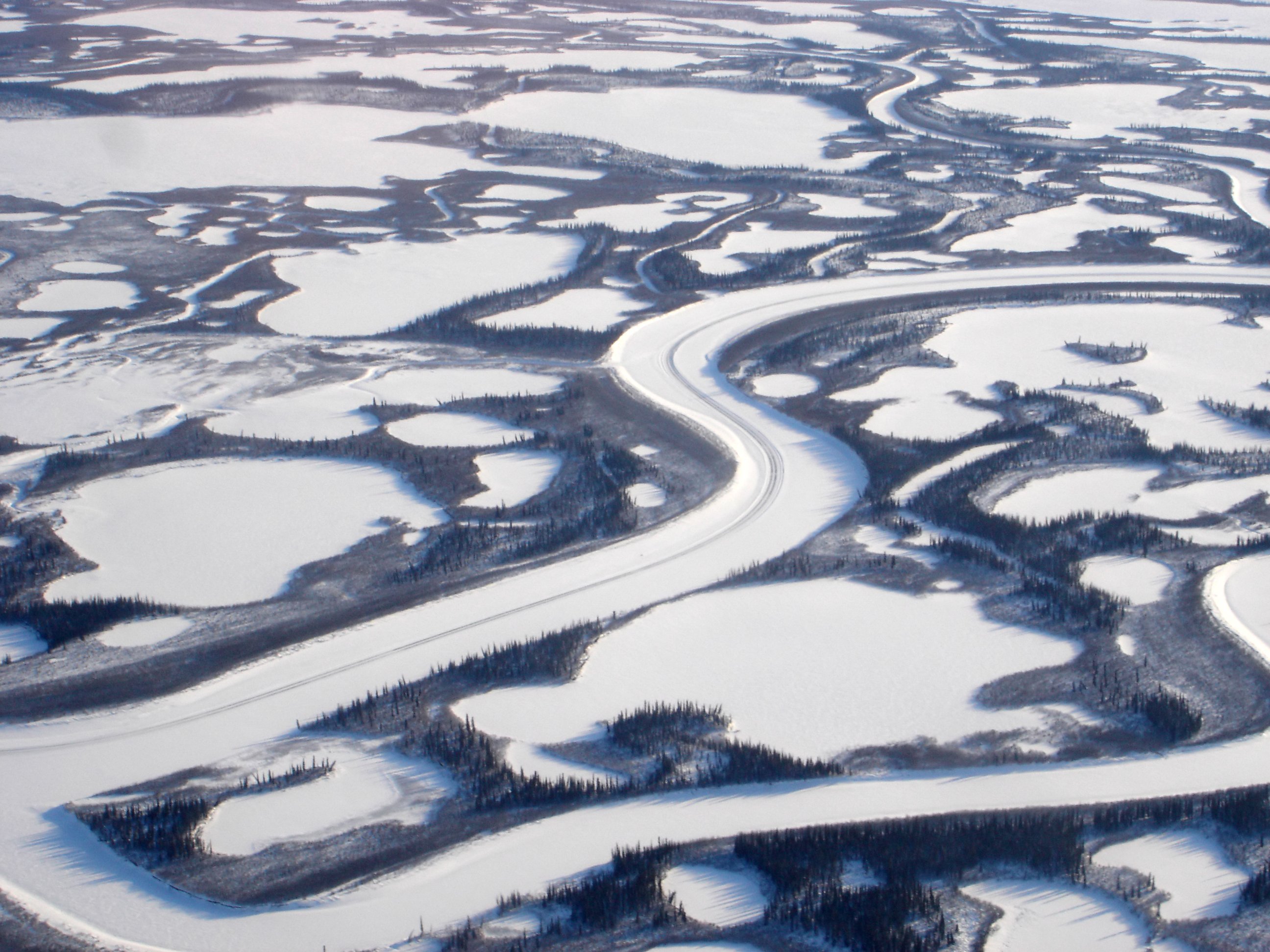
Sometimes called the Cold Amazon, the Mackenzie is a similarly wide, deep, and long river to the South American behemoth, one to three kilometres in width along most of its course and often speckled with inner islands. But one obvious difference between these two iconic rivers is the temperature: it’s cold in the Lower Mackenzie watershed!
A large portion of the river is ice laden a majority of the year, the Mackenzie River only beginning to open up in mid-May while the Great Slave Lake is often covered until mid-June. The river’s system also encompasses some of the most treacherous and rugged frozen landscapes in the world, crossing the Arctic Circle and flowing through the Canadian Shield.
The still-wild river
Though First Nations peoples have inhabited regions of the river for thousands of years, the fur and timber booms of the 1800s saw a marked increase in human populations. Muskrat, marten, beaver, lynx and fox populations were all hunted extensively during the fur trade, although population numbers today still remain healthy.
The river’s home to many well-known animals
The Mackenzie’s vast breadth of chilly wetlands and woodlands boast many iconic species. The caribou is a key part of the Mackenzie food web. In calving season, more than 5,000 belugas can be seen basking in the Mackenzie Delta.

Some 26 migratory birds rely on the watershed plus many basin and shore species, including osprey, tundra swans, geese, great-blue herons, sandhill cranes, and many species of ducks. Plenty of fish also call the river’s waters home like chinook salmon, steelhead, rainbow, bull and cutthroat trout, mountain whitefish and three-spine sticklebacks.
The river’s generally in good shape
Given the watershed’s remoteness, this has spared the Mackenzie from impacts commonly seen in more populated watersheds. Only two parts of the river are classified as regions of high pollution concern according to WWF’s Watershed Reports: the Central Mackenzie-The Ramparts and the Fort Nelson sub-watersheds.
Overall the threats to the Mackenzie Watershed vary from low to moderate in the assessed sub-watersheds. Habitat loss in the wooded southern portions of the watershed, and climate change in many parts of the watershed, are cited as the largest threats.
But there’s a lot of work left to do before we’ll truly know how the Mackenzie Watershed is doing. WWF’s report for the Lower Mackenzie Watershed’s health assessments show that there is a pronounced amount of data lacking in this region.
For more information, visit WWF’s watershed report here.
Written by Jennifer Huizen
Tune in every Wednesday at 8 p.m. ET/PT for WWF Water Wednesdays on Love Nature to learn more about current water conservation issues from around the world.