A place where some of Europe’s biggest glaciers meet the continent’s hottest volcanic springs, Iceland is often known as the Land of Fire and Ice. This island of extremes was formed about 25 million years ago, making it one of the youngest landmasses on the planet. But as a hotbed of geological activity, the volcanic processes that helped build the country continue today, adding to the rugged and sometimes unforgiving landscape highlighted in this gallery. To explore more exciting features found on the largely uninhabited island, watch Undiscovered Vistas II, now available on Love the Nature app.
Eldgjá

At 270 metres deep, 40 kilometres long, and—in many places—600 metres wide, Eldgjá is the largest volcanic canyon in the world. It was formed by a gigantic eruption in 934 that resulted in a lava field that covered 800-square-kilometres; it was the largest flood basalt in history. Today, an impressive waterfall known as Ófærufoss flows through the massive canyon, making it a must-see among explorers of Iceland’s rugged interior.
Skógafoss

The Skógafoss waterfall flows over a set of cliffs that once made up the country’s southern coast. Now situated on the Skoga River, about five kilometres inland, the cliffs create a clear division between Iceland’s coastal lowlands and its highlands. The dramatic falls plunging over the receded coastline are some of the country’s most iconic, and not simply because they’re so accessible—the massive cascade of water drops 60 metres off a broad plateau that stretches approximately 30 metres wide.
Reynisdrangar

These basalt sea stacks are found off the southern coast of Iceland, not far from the looming cliffs of Reynisfjall Mountain. Teeming with nesting Arctic terns, fulmars and puffins, these spiky cliffs stretch a stunning 65 metres out of the ocean. These formations are also located right next to the Reynisfjara shore, often regarded as the most impressive black sand beach in Iceland.
Thingvellir

Thingvellir National Park is located in an active volcanic area, where the continental drift can be clearly seen through the dramatic fissures and cliffs that cover the region’s landscape. At the south end of the park lies Thingvallavatn Lake, the largest natural lake in Iceland and home to the Silfra fissure, a rare geological feature that attracts divers from around the world hoping to snorkel directly between two continental plates in some of the world’s clearest waters.
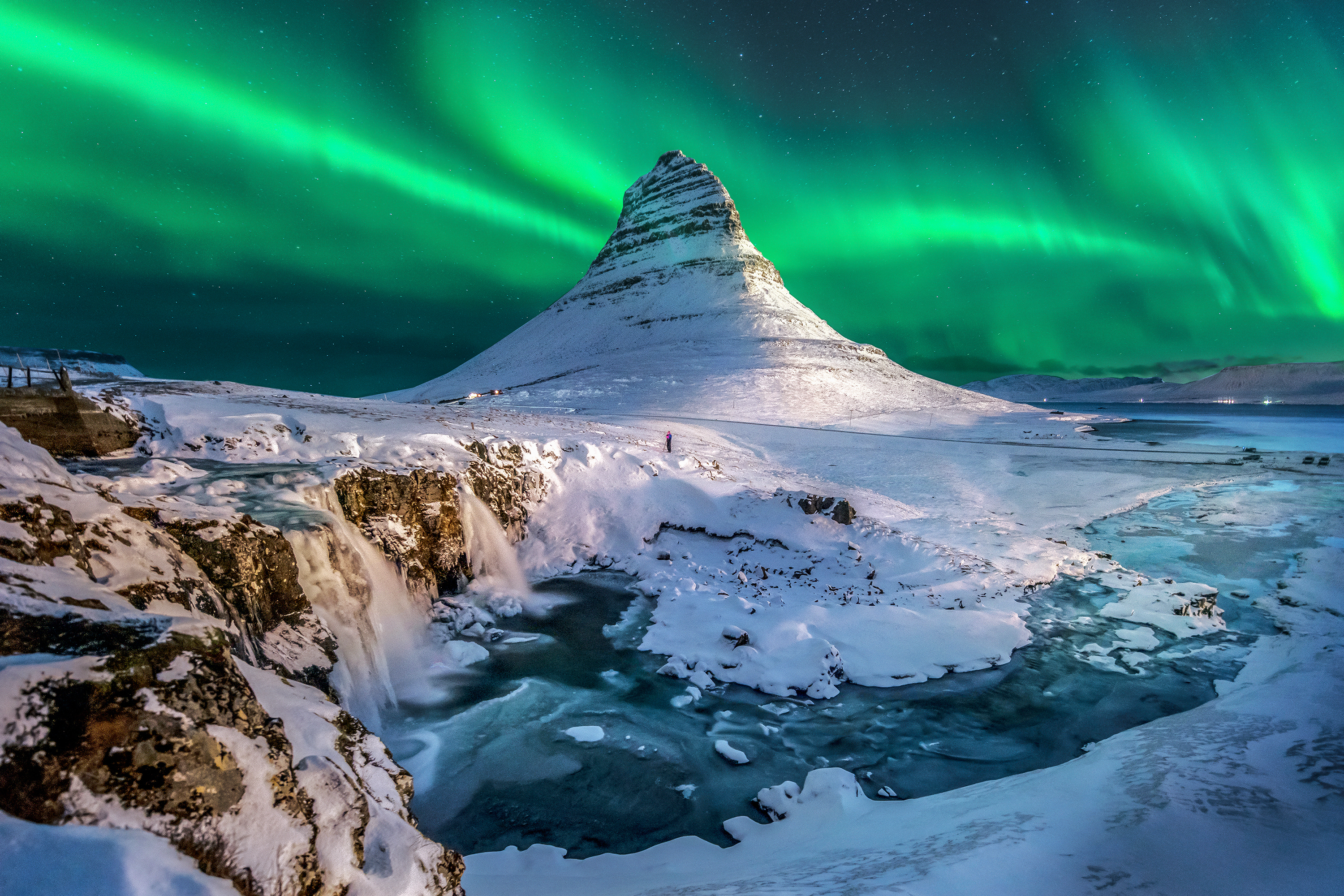
Snæfellsnes Peninsula

Located on the western coast of Iceland, Snæfellsnes Peninsula’s diverse landscape is marked by sparkling fjords, dramatic sea cliffs, commanding volcanic mountains, sand-covered beaches, and crunchy lava flows. Just a few notable landmarks along the 90-kilometre stretch include the Vatnshellir Cave, an 8,000-year-old lava tube that descends 35 metres below the surface; the black sand beaches of Djúpalónssandur and Dritvik; and the Eldborg Crater, which rises 60 metres from the surrounding lava.
Sandvik

Sandvik, which means “sand beach,” is found on the southernmost point of the Reykjanes peninsula, which is located between the North American and Eurasian continental plates. Sandvik’s black sand is a rarity among the geothermal landscape made up of mostly volcanic rock. However, the peninsula might be best known as the only place in the world where the Mid-Atlantic Ridge is visible above sea level.
Landmannalaugar Highlands

Known as the “Pearl of the Highlands,” Landmannalaugar is a must-see for those venturing into Iceland’s lesser-known interior. Part of Fjallabak Nature Reserve, Landmannalaugar sits 600 metres above sea level among multi-coloured mountains made up of rhyolite, a mineral-filled lava that cools unusually slowly, creating unconventional hues. This, combined with the region’s abundance of hot springs, have made Landmannalaugar a particularly noteworthy destination among hikers.
Hvalfjörður

The landscape of Hvalfjörður, an isolated fjord that’s also one of Iceland’s deepest, is as stunning as it is varied—large swaths of flat land contrast with soaring mountains and beaches that are broken into pieces by small creeks. The fjord is also home to the well-known Glymur waterfall, which was once thought to be Iceland’s highest set of falls at 198 metres. These falls gradually descend over rugged moss-lined volcanic rock to create one of the country’s most grandiose sights.
Svartifoss

Located in Vatnajökull National Park, Svartifoss is one of the most scenic waterfalls in Iceland, but not because of its narrow, 20-metre-high column of water. Svartifoss, which can be translated to Black Falls, is named after the dark columns of lava that line the horseshoe-shaped gorge framing the falls. The columns of lava are so stunning, in fact, that their natural beauty inspired the design for both the National Theatre of Iceland and the Hallgrimskirkja church in Reykjavik.
Strokkur

Stokkur is an extremely powerful geyser and an equally powerful sight. It lies on the geothermic field of Haukadalur, erupting every five to ten minutes, regularly reaching 20 to 30 metres high. Before it erupts, the pool gently pulsates up and down, while water temperatures reach a scalding 240 degrees Celsius. Although the water cools when it’s released, it’s still a steamy 80 to 100 degrees Celsius when it shoots from the geyser.